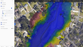
Always a lot going on..
I have had a serious of "near zero days" (reference hiking jargon), but I think they mostly just seem like zero days. I am getting stuff done, just not at 100% efficiency. Not sure anyone can move with 100% efficiency... Anyhow, I am planning on starting my next journey on May 1st. -- more details as they unfold. I know what I like and dislike. I know what turns me on and off. It's time for that knowledge to be guidance. We booked a trip to Wyoming/Yellowstone park in a few weeks. It will tackle at least three items that have been on my list 1.) Visit Yellowstone (in winter). 2.) A longish snowmobile trip. 3.) A visit to Wyoming. That will be my 50th state. That will make it all US states, 100 countries and all continents. I will likly be getting involved with MTP (Most Traveled People) https://mtp.travel/ where they break countries into regions. I decided I like this music. DiDuLa - "On the way home"


Comments