- Get link
- X
- Other Apps
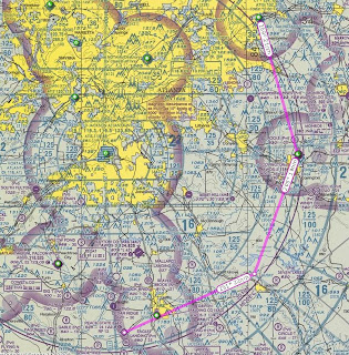
It was an aviation weekend. I spent a bunch of money (Ahh.. I mean time.. Hpmt..) in the air. Here is one of the flights shown mapped out on the chart. Cory and I went down to a 2400 foot grass strip skirting around and under the class bravo airspace of the world's busiest airport. It was a bit of an oxymoron. Navigating some of the worlds most complex airspace to land and have lunch at a primitive airport with a nice country restaurant/aviation museum. Loads of fun. I had blinders on most the time for simulated instrument time. It was bumpy and hazy. It was also 108 degrees F out. Needless to say, climb performance and comfort were issues. It "aint" much cooler 5000 ft in the air. The hazy picture shows what "home" looks like. It is (LZU) Gwinnett County Airport from the South on about a 1.5 mile left base for runway 25, although you can't quite see the airport off to the left.) It is refreshing to get a "good" look at things when the blinders come off. Reality is a lot different than what the instruments and charts say.
- Get link
- X
- Other Apps


Comments